Related Articles
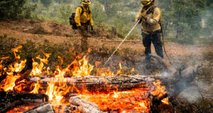
While crews fought to keep the Detwiler Fire in California’s Central Valley from reaching the historic gold rush town of Mariposa, a separate fire crew was watching the blaze from an entirely different angle – space. “We can see the darker reds here,” says Kris Mattarochia says science and operations officer at the National Weather Service Hanford office. “This is the fire temperature hot spot. We can see pretty much this is the current location of the Detwiler Fire.” During the Detweiler Fire, Mattarochia says his team was able to detect exactly how the fire was moving in almost real-time using images from a brand new satellite. There was a moment when one of his members saw a massive flare up of heat on the screens and contacted crews on the fire. “And he said hey, it looks it looks like this fire is getting hotter,” Mattarochia says. “Do you see the same thing on the ground? Basically the meteorologist on the ground said the fire did jump the line briefly.” This technology is called
https://mediad.publicbroadcasting.net/p/kvpr/files/styles/big_story/public/201708/detwiler_fire.gif
Wanna Comment?