Flat Fire Incident Information: Last Updated: September 21, 2016 9:30 am Date/Time Started: September 19,2016 2:13 pm Administrative Unit: Kern County Fire Department County: Kern County Location: off Granite Rd and Poso Flat Rd., 5 miles south of Woody Acres Burned – Containment: 306 acres – 100% contained Long/Lat: /-123.557
Read More »Canyon Fire (Santa Barbara County)
Canyon Fire Incident Information: Last Updated: September 18, 2016 6:45 pm Date/Time Started: September 17,2016 5:20 pm Administrative Unit: Vandenberg Air Force Base County: Santa Barbara County Location: Santa Ynez Ridge Road and Egress Road, south side of Vandenberg Air Force Base Acres Burned – Containment: **This is not a …
Read More »Owens River Fire (Wildfire)
The Owens River Fire Started on the afternoon of September 17th. The fire is burning north of the Owens River Road near Clark Canyon, east of Highway 395. It is burning in sagebrush and Jeffrey pine. Smoke is highly visible from locations throughout the Highway 395 corridor including Bishop, Mammoth …
Read More »Owens River Fire (Inyo County) Started 9/17/2016, updated 9/18/2016
Old Fire (Mariposa County)
Old Fire Incident Information: Last Updated: September 13, 2016 6:10 pm Date/Time Started: September 13,2016 1:55 pm Administrative Unit: Stanislaus National Forest County: Mariposa County Location: off Old Yosemite Rd, 8 miles east of Greeley Hill Acres Burned – Containment: 150 Acres — 70% Containment Long/Lat: -120.029626/37.75972
Read More »Auburn Fire (Nevada County)
Auburn Fire Incident Information: Last Updated: September 17, 2016 9:14 pm Date/Time Started: September 17,2016 1:40 pm Administrative Unit: CAL FIRE Nevada-Yuba-Placer Unit / Grass Valley Fire Department County: Nevada County Location: Off Auburn Street and Whiting Street, Grass Valley Acres Burned – Containment: 30 acres – 50% contained Long/Lat: …
Read More »Soup Incident (Wildfire)
The Soup Incident near the South Warner Wilderness is made up of five fires near Soup Springs Campground on the Modoc National Forest. Fire personnel and aerial suppression resources from multiple agancies and local governments are on scene of all five
Read More »Old Fire (Butte County)
Old Fire Incident Information: Last Updated: September 18, 2016 7:30 am Date/Time Started: September 16,2016 11:28 pm Administrative Unit: CAL FIRE Butte Unit County: Butte County Location: Off of Old Chico Canyon, west of Forest Ranch Acres Burned – Containment: 30 acres – 70% contained Long/Lat: -121.6998/39.8851
Read More »Gilman Fire (Wildfire)
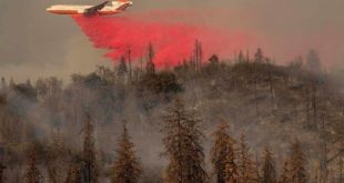
Gilman Fire has been reported N bound I-5 at O’Brien exit reported at 3 acres. Three federal air tankers have dropped 12,000 gallons of retardant on Gilman Fire, and forward fire spread has been stopped. Forest Service resources are on scene with assistance from Cal
Read More »Hog Fire (Tehama County)
Hog Fire Incident Information: Last Updated: September 13, 2016 2:30 pm FINAL Date/Time Started: September 13,2016 11:10 pm Administrative Unit: CAL FIRE Tehama-Glenn Unit County: Tehama County Location: Off Hwy 36 near Hog Lake, northeast of Red Bluff Acres Burned – Containment: 360 acres – 100% contained Cause: Under Investigation …
Read More »Boys Fire (Sacramento County)
Boys Fire Incident Information: Last Updated: September 12, 2016 7:00 pm FINAL Date/Time Started: September 11,2016 11:25 am Administrative Unit: CAL FIRE Amador- El Dorado Unit / Sac Metro Fire County: Sacramento County Location: off of Boys Ranch Road and Scott Road, northwest of Rancho Murieta Acres Burned – Containment: …
Read More »Moffett Fire (Siskiyou County)
Moffett Fire Incident Information: Last Updated: September 13, 2016 6:30 pm FINAL Date/Time Started: September 12,2016 4:28 pm Administrative Unit: CAL FIRE Siskiyou Unit County: Siskiyou County Location: off of Moffett Creek Rd and Luce Gulch Rd, northeast of Fort Jones Acres Burned – Containment: 32 acres – 100% contained …
Read More »Lightner Fire (Wildfire)
The Lightner Fire was reported at approximately 7:00 a.m., today, Monday, September 12, 2016. Air and ground resources responded to the fire, located near the Cow Flat and Lightner Peak area, of the Breckendridge Mountains.At 7:38, Tanker 108 reported the fire to be 1/4 acre in size in grass and …
Read More »