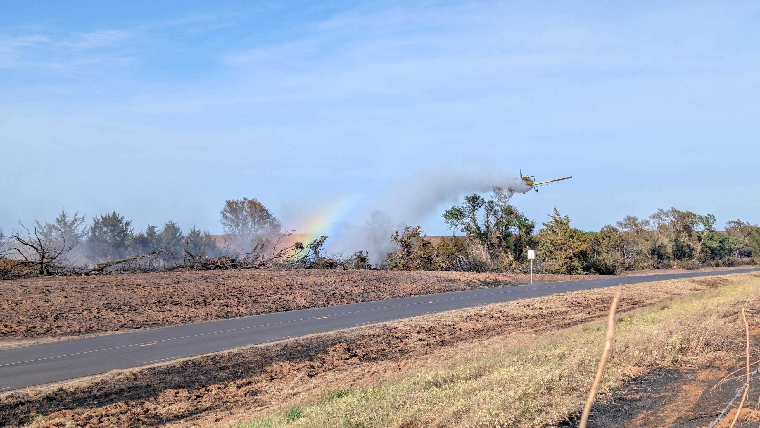
On May 14, 2026 a powerful storm system moved through southwest Kansas. Lightning strikes, fueled by strong winds and very dry vegetation, started multiple fires across the landscape. The fires quickly surpassed the local and mutual aid response. State assistance was requested. Aviation, KFS DFMOs, and in-state Wildfire Taskforces were mobilized. Many of the initial fires merged and are now being managed as a complex fire. Kansas Governor Kelly issued a State of Emergency Declaration on Friday, May 15, 2026. Local declarations have been issued; there is no federal emergency declaration.
On Monday, May 18, the Meade County Fires are now under one Incident Command System and will be called the Meade Lake Complex.
On May 20, 2026, the fire region received precipitation and higher humidity, which helped increase containment on both complexes. Non-local resources will be returned to their home units, and the fires will be monitored and patrolled by the local fire departments. The weather conditions in southwest Kansas have not dramatically changed. There is still potential for new starts to burn intensely and grow rapidly.
The fires under the Meade Lake Complex are the Wolf Canyon Fire, the Meade County Complex 1 and 2, the Proffitt Lake fire, and the 2 unstaffed fires in the southern part of the county.
Meade Lake Complex - Jeff Latham and Troy Mueller - Incident Commanders
- 91,616 acres
- 100% contained
The 500-Acre Pond Fire and the Herman Range Fire grew together on Sunday May, 17, 2026. All fires in Clark County will also be a complex of fires. The complex will include the Bouziden Range Fire and the Lexington Fire
Herman Range Complex - Chad Maybery Incident Commander
On Monday, May 18, 2026, the Herman Ranch Fire made a significant run to the south when the forecasted cold front impacted the fire’s open containment lines along the southern edge of the incident. The acres and map do not reflect that event.
- 36,194 acres
- 90% Contained