
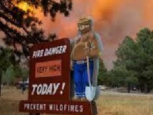
Wildfire caused by lightning.
| Current as of | Sun, 07/19/2026 - 23:53 |
|---|---|
| Incident Type | Wildfire |
| Cause | Lightning |
| Date of Origin | |
| Location | Nespelem Okanogan / Kaiser Canyon |
| Incident Commander | Andrew Stenbeck Northeast WA Interagency Team 3 |
| Incident Description | Wild Fire/lightning / natural cause |
| Coordinates |
48° 7' 01'' Latitude
-118° 57' 52 '' Longitude |
| Total Personnel: | 438 |
|---|---|
| Size | 60,226 Acres |
| Percent of Perimeter Contained | 0% |
| Estimated Containment Date | 09.30.2643 |
| Fuels Involved | Primary fuels are tall grass, brush, and timber with grass and understory. Bitterbrush patches are present on the eastern and northern slopes. Steep, rocky terrain in an old burn scar area contains light and heavy flashy fuels, hazard trees, conifer trees, and slash piles that provide extra fuel for the fire. |
| Significant Events | The wildfire started approximately 1 mile south of Nespelem, WA. Significant fire behavior has been observed, and the fire front has been pushed by shifting winds and hot, dry weather. The fire has made significant runs with erratic winds and has pushed past Owhi Flats and across into Ferry County. Structure protection and community safety are the primary goals of fire suppression. The focus will continue to be on point protection and stopping the forward progression of the fire. Fuels are dry and are susceptible to fire spread by wind and terrain. Additional resources have been ordered to assist in fire suppression activities. Rapid wind-driven fire growth has pushed the fire front north and northeast of Nespelem toward Omak Lake. Road closures and evacuations continue near the fire perimeter for community and firefighter safety. Very active fire behavior has also pushed the fire into conifer forested areas, which has increased fire length and forward movement. |
| Planned Actions |
Point protection of residences, stopping the forward progress of the fire, and containing the fire by building strong containment lines, utilizing fire crews, dozers, hand crews, engines, brush trucks, and air support. |
|---|---|
| Projected Incident Activity |
Full direct fire suppression and point protection. Structure protection, support from hand crews, engines, brush trucks, tenders, dozers, and air support aimed at stopping forward fire protection and growth. Active fire spread influenced by wind and low HR with steep terrain will be challenging for fire crews. In the coming, additional resources will be placed on the front lines in tandem with air support for full fire suppression activities. Coordination activities with both Okanogan and Ferry County Emergency Management and the Department of Natural Resources will aid the incoming Incident Management Team, Mt. Tolman, and the Colville Agency on fire suppression efforts. |
| Remarks |
Primary focus is community safety and securing the town of Nespelem and Colville Agency from the fire. |
| Weather Concerns | Temperatures will be in the mid 90s with very low RH down to 15%. The prediction is for possible rapid fire spread at the head of the fire. Hot, dry and windy conditions will remain for the next 24-48 hours in the region. |
|---|