
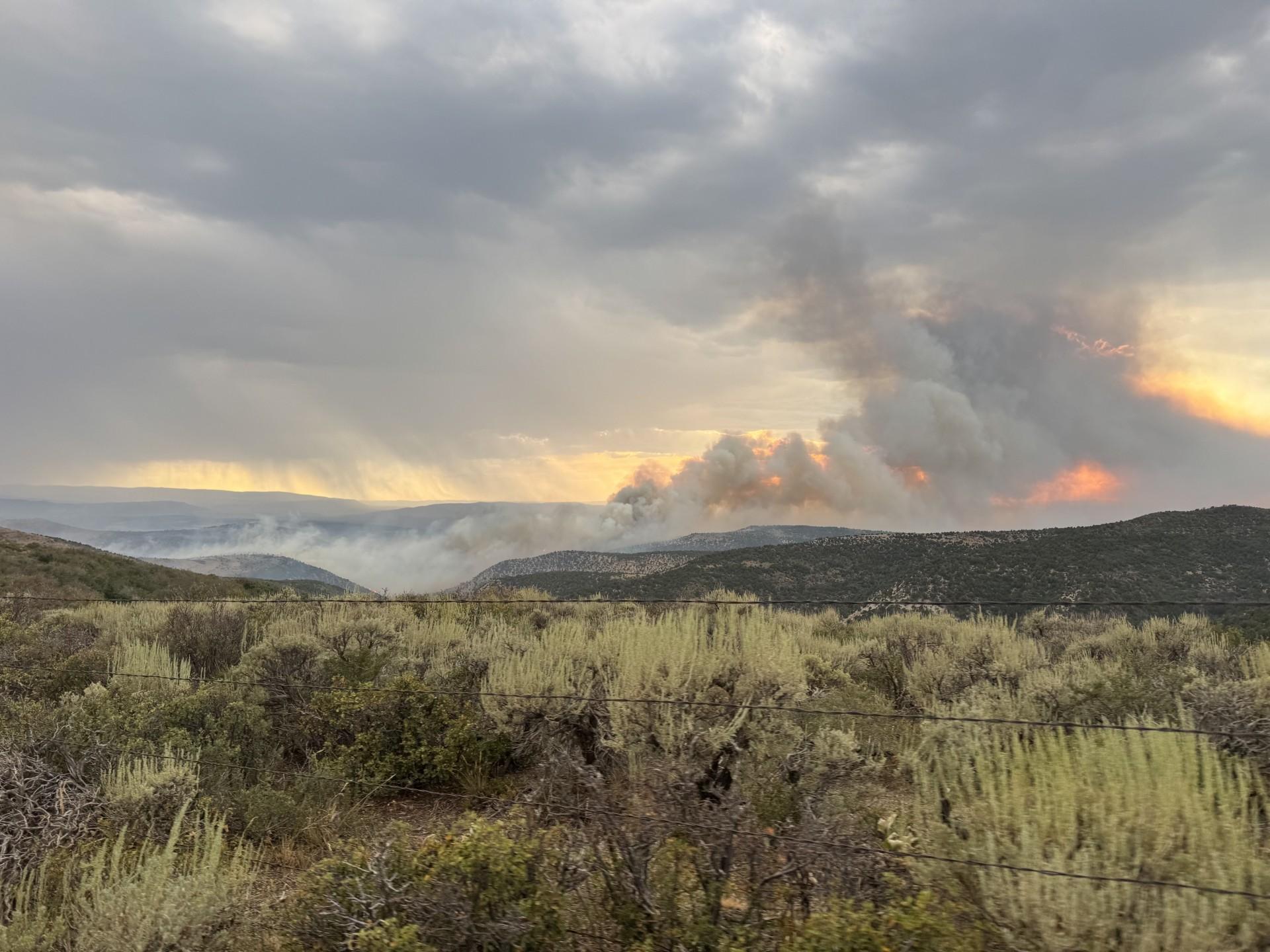
The Keystone Fire was ignited by lightning in the 2018 burn scar of the Indian Valley Fire on July 21, 2026. Local, state and federal ground and aerial firefighting resources responded and worked together to put retardant and water on the fire as quickly as possible. By evening, the Northwest Colorado Fire Management Unit placed an order for a Type 3 Incident Management Team, and Team Colorado assumed command of the fire at 6:00 a.m. July 23. There are currently no human lives or structures threatened.
| Current as of | Thu, 07/23/2026 - 11:56 |
|---|---|
| Incident Time Zone | Mountain Standard Time |
| Incident Type | Wildfire |
| Cause | Natural/Lightning |
| Date of Origin | |
| Incident Time Zone | Mountain Standard Time |
| Location | BLM White River Field Office -- northeast of Highway 64 and Black Mountain Wilderness Study Area |
| Incident Commander | Philip Daniels, Incident Commander Brendan Finnegan, IC trainee Team Colorado |
| Coordinates |
40° 13' 23'' Latitude
-108° 10' 69 '' Longitude |
| Total Personnel: | 150 |
|---|---|
| Size | 3,024 Acres |
| Percent of Perimeter Contained | 2% |
| Fuels Involved | The fire is burning in grass, oak and sagebrush, and piñon/juniper mix. |
| Significant Events | Current Situation: Three divisions have been established by Operations. In Division W (west flank), firefighters are scouting and locating opportunities for potential primary and alternate fireline locations for the highest probability of success. The area is difficult to access so UTVs are being utilized. In the northwestern region of the fire (Division A), crews and engines are building direct and indirect fire containment lines to protect values at risk, including rural residences and ranching properties, oil, gas, and electric infrastructure, grazing allotments, and wildlife habitat. Firefighters in Division D (northeast) are constructing direct fireline and scouting for potential line placement to contain the fire. |
| Planned Actions |
Firefighters are scouting and locating opportunities for potential primary and alternate fireline locations for the highest probability of success. Crews and engines are building direct and indirect fire containment lines to protect values at risk, including rural residences and ranching properties, oil, gas, and electric infrastructure, grazing allotments, and wildlife habitat. Firefighters are constructing direct fireline and scouting for potential line placement to contain the fire. |
|---|
| Weather Concerns | The wind will be out of the southwest in the morning, switching to west this afternoon which may pressure the east and north flanks. Head fire max rates of spread are estimated to be 14-27 chains/hour and flames lengths up to 4-6 feet in the grass and brush. Gusty and erratic winds could develop with the possibility of thunderstorms and instability in the afternoon. |
|---|