

Filter - control incident types displayed on map.
Zoom to your location
Reset map zoom and position
Show Legend
Unit Information
Oregon
Vale,
Oregon
97918
Agency Name: Bureau of Land Management

Agency Abbreviation
BLM
Oregon
Vale,
Oregon
97918
Agency Name: Bureau of Land Management
Agency Abbreviation
BLM
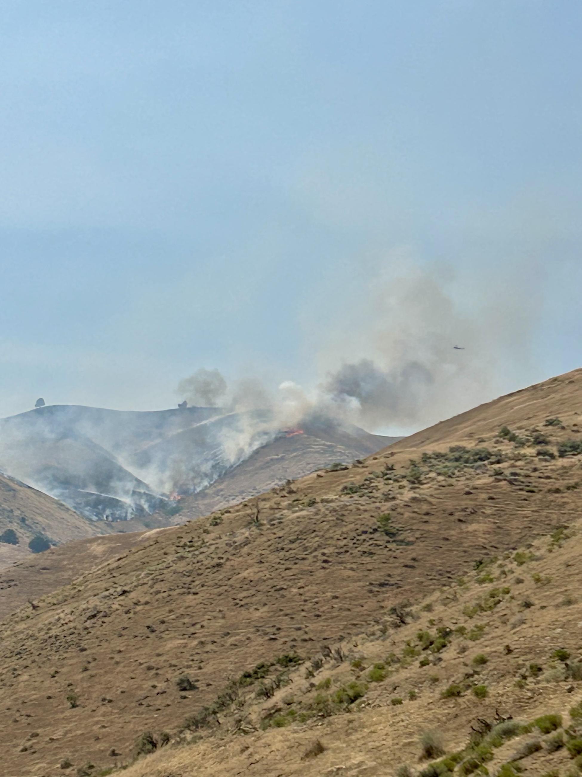
The Fox Fire was reported on July 23, 2026. It is exhibiting extreme fire behavior with uphill runs in grass. The Southwest Area Incident Management Team 3 also has command of the Powder River Fire and will combine updates for the Fox Fire.
Evacuations are in place issued by Baker County Sheriffs Department and can be viewed here: https://arcg.is/0iKuO91
Fire Restrictions: The Bureau of Land Management has issued a Notice of Temporary Restriction Order for the Vale District: https://www.blm.gov/sites/default/files/docs/2026-07/orwa-fpo-val-070626.pdf
Smoke: Smoke from the Fox Fire and other surrounding fires, continues to affect portions of eastern Oregon and neighboring areas. Individuals, especially those with respiratory conditions, should monitor local air quality reports and limit outdoor activities when smoke concentrations are high. For more information: https://outlooks.airfire.org/outlook/ad8568e1
| Current as of | Fri, 07/24/2026 - 23:42 |
|---|---|
| Incident Time Zone | Pacific Standard Time |
| Incident Type | Wildfire |
| Cause | Undetermined |
| Date of Origin | |
| Incident Time Zone | Pacific Standard Time |
| Location | 12 Miles NE of Huntington, OR |
| Incident Commander | Kenneth Watkins, IC SWCIMT3 |
| Coordinates |
44° 31' 26'' Latitude
-117° 12' 47 '' Longitude |
| Size | 2,477 Acres |
|---|---|
| Percent of Perimeter Contained | 0% |
| Fuels Involved | Short Grass (1 foot) Tall Grass (2.5 feet) Narrative: |
| Significant Events | Active fire behavior was observed on all sides of the Fox fire today. Fire behavior consisted of active backing downhill in steep terrain, with uphill runs. |
| Planned Actions |
In Division W, resources will assess opportunities for both direct and indirect tactics to protect values at risk while using ground and aviation assets. Division B will assess opportunities for both direct and indirect tactics to protect values at risk while using ground and aviation assets. |
|---|---|
| Projected Incident Activity |
12 Hours: Fire behavior will slow overnight, with activity consisting of backing downhill, with short uphill runs. Widespread smoky conditions. 24 Hours: Expect extreme fire behavior. Fire will continue to be active on all flanks. Fire will be active on all flanks with upslope/updrainage runs where wind and slope align. Widespread smoky conditions. Very dry and windy conditions. 48 Hours: Expect extreme fire behavior. Fire will continue to be active on all flanks. Fire will be active on all flanks with upslope/updrainage runs where wind and slope align. Widespread smoky conditions. Very dry and windy conditions. |
| Remarks |
In addition to the Fox Fire, the SWCIMT3 also has command of the Powder River Fire and updates will be combined until further notice. |
| Weather Concerns | Mostly sunny and hot conditions over the fire today with areas of smoke. Daytime highs in the 90s. Red Flag Warning for gusty southwest winds to 35 mph with humidity values from 10-20%lasts from 1 pm Friday through 8 pm Saturday. Humidity recovery tonight will be poor, only around 30-40% with overnight lows in the 60s and lower 70s. The forecast remains dry through the weekend and into early next week with breezy southwest winds and low humidity conditions continuing. |
|---|